Try This Trail: Ed’s Trail on Silver Star Mountain
The hills are alive, but not with the sound of music. (It’s wildflowers and lots of grass.)
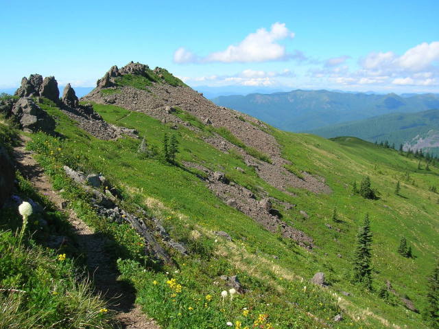
Photo courtesy Craig Romano
Trail Name: Ed’s Trail on Silver Star Mountain
Rating: Difficult
Distance: 5 miles round trip
The four-volcano view from Silver Star near Vancouver, WA, is stellar; so is the vista over the Columbia River to Portland. Even better are the now-in-progress floral displays from the high slopes of this fluted peak. Saunter up slopes that were scorched clean of timber in Washington’s big burn of 1902; now they’re alpine meadows bursting with brilliant wildflowers.
For the shortest and most popular route to the former fire lookout site, follow Ed’s Trail through bear grass and check out the backdrop of snowy volcanoes. At 0.5 mile, veer left to skirt above, around, and beneath ledges and knobs. At 1.5 miles, pass through the trail’s highlight landmark, a rock arch that resembles two robots butting heads.
After a short but steep section of trail requiring use of your hands, meet up again with the old road at 2.1 miles. Head left, soon meeting a junction. Head left again, reaching Silver Star’s 4,390-foot open summit in 0.3 mile. The views of Mounts Hood, Rainier, Adams, and St. Helens are impressive, as is the plethora of minor but equally beautiful peaks and ridges. When it’s time to return, retrace steps back to the old road and follow it through meadows. It’s a much easier descent than returning via Ed’s.
Watch For: Rock pits near the summit were once used by young Native Americans for vision quests.
Getting there: Take Exit 11 on I-5 and follow SR 502 east to Battle Ground. Head north 5.6 miles on State Route 503 and turn right onto Rock Creek Road, which becomes Lucia Falls Road. Continue east for 8.4 miles. Turn right onto Sunset Falls Road and follow it for 7.3 miles to Sunset Campground. Turn right onto rough and bumpy Forest Service Road 41 for 3.5 miles. Turn right onto Forest Service Road 4109 and after 1.5 miles bear left, continuing for 2.7 miles to the trailhead.
Craig Romano is the author of eight hiking books, including Day Hiking Olympic Peninsula and Backpacking Washington.


