


Image: Kati Lacker
What makes Seattle weather so hard to predict? It’s the microclimates. The city’s shorelines and topography can mean a gorgeous day in one neighborhood but a rainy one across town.
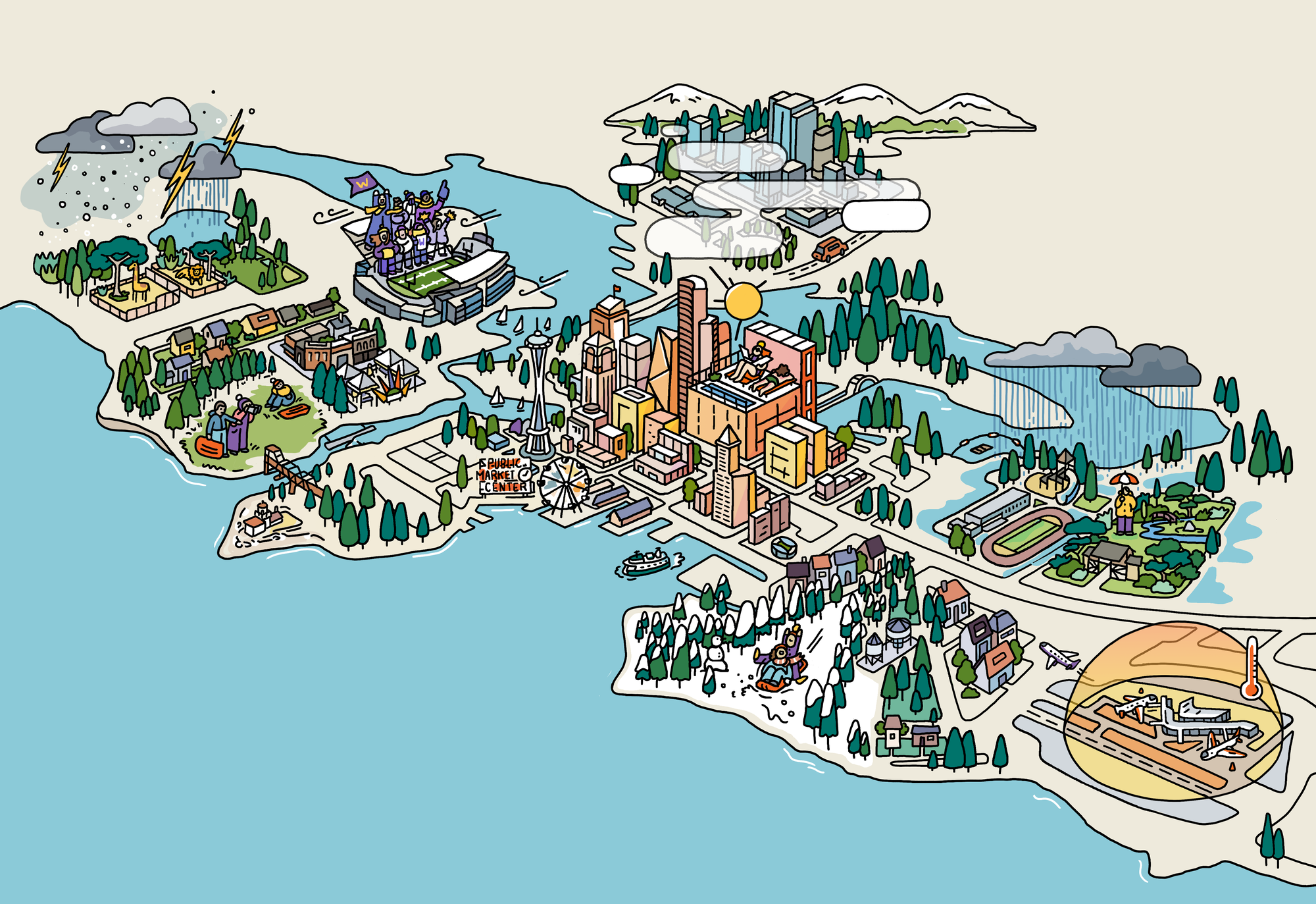
Image: Kati Lacker
1) The Wild Zone
Green Lake North
From Green Lake north to Shoreline, and heading eastward, the Puget Sound Convergence Zone is a narrow band of active weather infamous for producing heavy rain, hail, lightning, and even snow. The phenomenon is caused by winds that collide after journeying around the Olympics.
Image: Kati Lacker
2) The Snow Hole
Ballard
If you’re a snow lover, Ballard is guaranteed to disappoint. Its low elevation and proximity to the shores of Puget Sound mean that during marginal snow events—which is how most Seattle snowfalls go—Ballard is usually stuck under a miserable 35-degree rain while snow piles up to the north, south, and east.
Image: Kati Lacker
3) The Wind Tunnel
Husky Stadium
Bring your sweater, scarf, and hat for football games at UW during storm season. The winds are known to whip mercilessly through the stadium, especially if you’re sitting in the exposed north stands, where the cold breeze just plain stings.
Image: Kati Lacker
4) The Sun Capital
Downtown
It’s ironic that in a city internationally renowned for rain, the heart of Seattle is typically its driest and sunniest part. You can thank West Seattle for this, as its higher terrain blocks some of the raindrops headed for downtown.
Image: Kati Lacker
5) The Snow Belt
West Seattle
Every extra inch of elevation matters for Puget Sound snow, as West Seattle’s hilltop residents know. It’s not unusual for the highest spots in the neighborhood to be sprinkled with snowflakes while a cold rain drenches Alki Beach.
Image: Kati Lacker
6) The Fog Zone
Eastgate/South Bellevue
Drivers heading from Seattle to Issaquah often feel like they’re entering a wall of fog when they hit this mile-long stretch near exit 11 on Interstate 90. The rapid increase in elevation here often leads to a sharp drop-off in temperatures over a short distance, allowing fog to form on a dime.
Image: Kati Lacker
7) The Wettest Place
Rainier Beach
This southern stretch on Lake Washington receives about 40 inches of rain a year—more than any other neighborhood in Seattle. This is because it’s furthest away from the rain-shadowing effects of the Olympic Mountains and close to the rising air of the Issaquah foothills.
Image: Kati Lacker
8) The Heat Dome
Sea-Tac
Asphalt, no trees and a multitude of planes, buildings and people—it’s no surprise Sea-Tac Airport is consistently the hottest part of the Seattle area during the summer. Of course, taking temperature measurements between the runways doesn’t help.
Published in the Weird Wild Wonderful Weather, Explained issue of Seattle Met.
|
|
|